
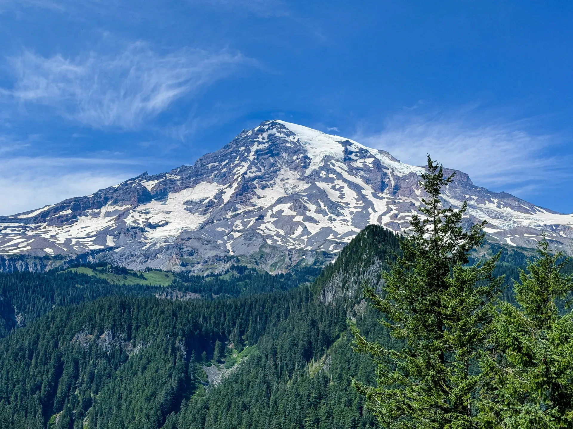
Mount Rainier rises 14,410 feet above west-central Washington, dominating the Cascade Range skyline. The active volcano supports 25 named glaciers and spans 236,382 acres of protected national parkland.
Mount Rainier rises 14,410 feet above sea level, 65 miles southeast of Seattle. The active volcano anchors a 236,382-acre national park in west-central Washington. Twenty-five named glaciers cling to its flanks, forming the largest single-mountain ice system in the contiguous United States outside of Alaska. These massive ice fields cover 100 square miles and feed five major Pacific Northwest river systems.
Visitors encounter drastic elevation shifts from 1,600-foot lowland old-growth forests to the glaciated summit. Subalpine meadows at Paradise erupt with purple lupine, red paintbrush, and white avalanche lilies during the short summer window of July and August. At Sunrise, the highest vehicle-accessible point at 6,400 feet, the Emmons Glacier dominates the immediate view. Hikers navigate over 275 miles of trails, ranging from the flat 0.1-mile Kautz Creek boardwalk to the multi-day Wonderland Trail that circles the entire mountain.
Accessing the park requires planning around severe weather and strict regulations. Sunny mornings at the base often give way to freezing temperatures and zero visibility near the summit. Between November and April, heavy snow closes most roads, including the route to Sunrise. During these winter months, all vehicles entering the park must legally carry tire chains, regardless of four-wheel-drive capabilities.
The park operates 24 hours a day, charging a $30 vehicle entry fee. Cash is not accepted at any entrance station or campground. Summer crowds cause massive delays at the Nisqually and White River Entrances, forcing late arrivals to wait hours just to pass the gates. Driving from Seattle-Tacoma International Airport takes about two hours via Interstate 5 and State Route 706. This route leads directly to the Nisqually Entrance in the southwest corner, providing year-round access to Longmire and Paradise. Visitors without personal vehicles must rely on private shuttle services like Talking Rocks from Enumclaw or book guided commercial tour buses from Seattle hotels. Drones are strictly prohibited everywhere inside the park, and visitors caught flying them face hefty federal fines. Checking the official webcams before driving out saves time, as thick clouds frequently obscure the peak entirely.
Humans arrived in the Mount Rainier region approximately nine thousand years ago. Local Coast Salish tribes, including the Cowlitz, Muckleshoot, Nisqually, Puyallup, Squaxin Island, and Yakama people, established deep ties to the land. They called the mountain Takhoma. These groups utilized the lower slopes for hunting and gathering during the summer months, leaving behind archaeological evidence of seasonal camps. The glacial runoff sustained the salmon runs essential to their survival and cultural practices.
Captain George Vancouver recorded the first European sighting of the peak in 1792 during his voyage into Puget Sound. He named the mountain after his friend, British Admiral Peter Rainier, who never set foot in North America. For decades, the dense old-growth forests and rugged terrain kept explorers from reaching the base. Hazard Stevens and P.B. Van Trump completed the first documented summit climb in 1870. Twenty years later, Fay Fuller became the first recorded woman to reach the 14,410-foot crest in 1890. These early expeditions required weeks of bushwhacking just to reach the snowline.
Congress designated Mount Rainier as the fifth national park in the United States on March 2, 1899. The establishment of the park required significant lobbying by scientists, mountaineers, and local businesses who recognized the area's unique geology. Early park administrators struggled to balance conservation with the push for tourism infrastructure. By the 1920s, thousands of visitors arrived by automobile, prompting the construction of the scenic road to Sunrise. This engineering feat required blasting through solid rock and navigating sheer cliffs to reach the 6,400-foot elevation. Crews constructed the National Park Inn at Longmire and carved winding mountain roads through the steep terrain. The entire park now operates as a National Historic Landmark District, protecting late 19th-century rustic log and stone architecture alongside the natural landscape.
Today, the park manages around two million annual visitors while monitoring constant geological threats. Geologists classify Mount Rainier as an episodically active volcano. The last minor eruption occurred roughly 150 years ago. Scientists maintain a vast network of seismic sensors across the slopes to detect early warning signs of lahars or pyroclastic flows. The landscape continues to shift, evidenced by a recent major flood event that destroyed the suspension bridge leading to the Grove of the Patriarchs. Visitors exploring the Longmire historic district can still walk the flat Trail of the Shadows loop to see the bubbling mineral springs that first drew tourists to the area.
Successive lava flows of andesite and dacite built Mount Rainier over the last 500,000 years. The mountain boasts a topographic prominence of 13,211 feet, making it the most visually dominant peak in the Cascade Range. Columbia Crest sits at the highest point of the volcanic caldera, reaching exactly 14,410 feet above sea level. The volcano remains geologically young and active, with heat from the crater melting snow to form a labyrinth of ice caves near the summit.
One hundred square miles of ice blanket the upper slopes. The Nisqually Glacier, visible from the Paradise area, advances and retreats noticeably over decades, grinding volcanic rock into fine glacial flour. The Emmons Glacier covers the largest surface area of any glacier in the contiguous United States. These ice fields act as massive water towers, releasing meltwater that sustains the White, Carbon, Puyallup, Nisqually, and Cowlitz rivers.
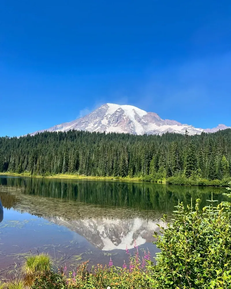
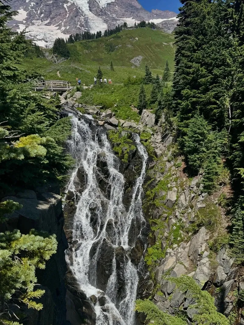
Below the ice line, the landscape fractures into deep rocky gorges and alpine lakes. Reflection Lakes sit just south of Paradise, providing a mirror image of the mountain on windless days. Waterfalls cut through basalt cliffs throughout the park. Myrtle Falls drops 72 feet into a rugged gorge right along the paved Skyline Trail. Hikers approaching the falls hear the roar of the water long before the viewpoint opens up.
The dramatic elevation gradient supports diverse ecosystems. The lower elevations receive massive amounts of rainfall, fostering lush old-growth forests of Douglas fir, western red cedar, and western hemlock. Some of these trees exceed 1,000 years in age and reach heights of 200 feet. As the elevation increases, the dense forest thins into subalpine parkland. Here, the harsh winter conditions stunt tree growth, creating twisted, weather-beaten krummholz formations. The volcanic soil in these meadows provides the perfect nutrients for the dense carpets of wildflowers that bloom in late summer.
The Naches Peak Loop winds through the eastern edge of the park near Tipsoo Lake. Walking this trail clockwise keeps the eastern face of Mount Rainier constantly in view. The terrain here transitions from dense forest into open subalpine meadows dotted with sparkling tarns. During late summer, the meadows turn red and gold with autumn foliage. Visitors ascending rapidly to these 6,000-foot elevations often experience mild altitude sickness, requiring frequent breaks to adjust to the thinner air.
Mount Rainier anchors the cultural identity of the Pacific Northwest. For thousands of years, the Cowlitz, Muckleshoot, Nisqually, Puyallup, Squaxin Island, and Yakama tribes have revered Takhoma as a sacred life source. The mountain's glacial runoff sustains the salmon runs essential to Indigenous diets and spiritual practices. Tribal nations maintain active treaty rights within the park boundaries, continuing traditional harvesting and ceremonial practices on their ancestral lands.
The peak dominates the horizon for millions of Washington residents. It dictates local weather patterns, casting a massive rain shadow that shapes the region's agriculture. The mountain's silhouette appears on state license plates, local business logos, and regional art. Its massive silhouette constantly reminds residents of the area's volatile geology. Residents live with the knowledge that a major eruption could send massive mudflows down the river valleys into heavily populated suburbs.
Mountaineering culture revolves around the volcano. Roughly 10,000 climbers attempt the summit each year, using the heavily crevassed routes as training grounds for Himalayan expeditions. The mountain demands respect, as unpredictable storms and deep crevasses turn routine climbs into survival situations. Guide services operate out of Ashford, leading roped teams across the glaciers from May through September.
The rustic architecture of the park facilities established a specific design style that influenced public land development across the country. The National Park Inn and Paradise Inn utilize massive timber logs and local stone to blend into the rugged environment. Visitors can still sit in the timber-framed lobby of the Paradise Inn, built in 1916 from silver fir trees salvaged from a local forest fire.
Beyond the park boundaries, the mountain influences regional recreation. The Gifford Pinchot National Forest stretches directly south, providing extensive wilderness areas for camping and hiking away from the national park crowds. Just outside the Nisqually Entrance, the Mt. Rainier Scenic Railroad in Elbe runs historic steam trains through the foothills. Passengers ride vintage railcars while sampling local Washington ciders, watching the mountain loom over the pine trees.
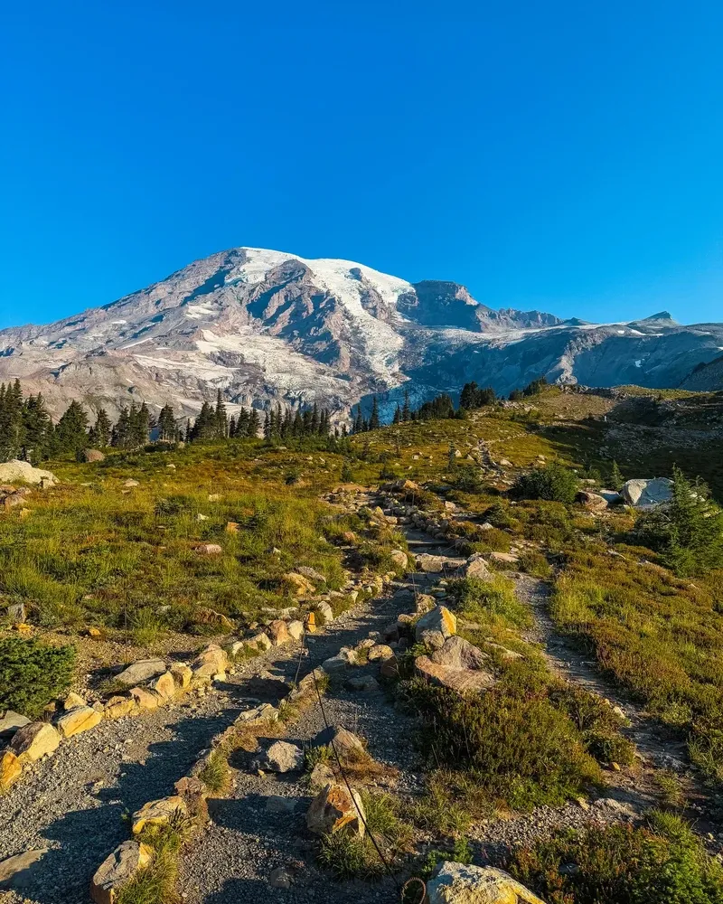
Columbia Crest sits on the volcanic caldera rim, reaching exactly 14,410 feet above sea level.
Twenty-five named glaciers cover 100 square miles of the mountain's upper slopes.
Fay Fuller became the first recorded woman to summit the mountain in 1890.
Congress designated Mount Rainier as the fifth national park in the United States in 1899.
Glacial meltwater from the peak feeds five major Pacific Northwest river systems.
Federal law requires all vehicles to carry tire chains from November 1 to May 1, regardless of weather.
Launching or operating unmanned aerial vehicles is strictly prohibited anywhere within the park boundaries.
Yes, geologists classify Mount Rainier as an episodically active volcano. Its last minor eruption occurred about 150 years ago, and scientists continuously monitor it for seismic activity.
No, the park will not require timed entry reservations in 2026. Park officials will use parking management strategies to handle peak-season congestion instead.
No, all entrance stations and campgrounds operate on a cashless system. Visitors must pay the $30 vehicle fee with a card or pre-purchase a pass at local businesses in Ashford.
Pets are strictly prohibited on all hiking trails and in the backcountry. They are only allowed in parking lots, campgrounds, and on paved roads while on a six-foot leash.
Sunrise is the highest vehicle-accessible point at 6,400 feet. The road to Sunrise typically opens in early July and closes for the winter by mid-October.
Launching, landing, or operating drones is strictly prohibited within park boundaries. Federal law enforces this ban to protect wildlife and maintain the natural quiet of the area.
No public buses or trains travel directly from Seattle or SeaTac Airport into the park. Visitors without cars must book private shuttles or join commercial guided tours.
Yes, all vehicles must carry approved tire chains inside the park between November 1 and May 1. This legal requirement applies regardless of your vehicle type or the current weather conditions.
Roughly 10,000 climbers attempt to reach the 14,410-foot summit annually. The challenging, heavily crevassed routes require technical mountaineering skills and specialized gear.
The Grove of the Patriarchs remains closed indefinitely. A major flood event destroyed the suspension bridge required to access the island of ancient trees.
Browse verified tours with free cancellation and instant confirmation.
Find Tours